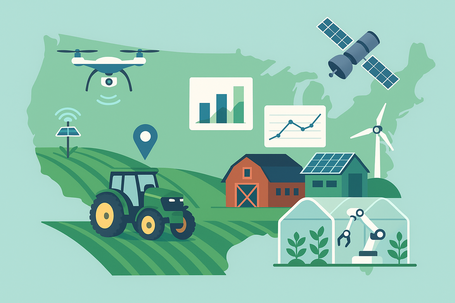
All-Weather Eyes on the Field: How SAR Satellites Are Rewiring Crop Intelligence
For decades, remote sensing has promised farmers a bird’s-eye view of crop health, soil conditions, and risks. In practice, cloud cover, uneven revisit rates, and inconsistent data quality often left that promise unfulfilled at the moments when decisions mattered most. A new generation of synthetic aperture radar (SAR) satellites is changing that calculus, providing reliable, high-resolution insight through clouds, haze, and darkness—and rapidly moving from research plots into agronomic software, finance, and risk management.
What SAR Does Differently
Unlike optical satellites, which capture reflected sunlight, SAR uses microwave energy transmitted from the satellite and measures the backscatter that returns from the Earth’s surface. Because microwaves penetrate clouds and are independent of daylight, SAR collects usable data in nearly any weather and at night. Frequencies (bands) and polarizations determine how signals interact with surfaces: C-band (used by many public missions) is well-suited to broad monitoring at around 10-meter resolution, while X-band and other commercial constellations push into sub-meter detail for targeted analysis. Dual polarizations (e.g., VV and VH) and time-series “coherence” reveal subtle structural changes in fields that optical sensors often miss.
Why It Matters to Agriculture
Timeliness and reliability are everything in agriculture. Planting windows can close in days, storms strike unpredictably, and scouting misses can grow into costly mistakes. SAR’s value rests on four pillars:
- Consistency: Cloud-immunity translates to predictable monitoring cadences, ensuring that mid-season assessments and post-storm checks occur on schedule.
- Sensitivity to Structure and Moisture: SAR backscatter and coherence reflect canopy structure, surface roughness, and near-surface soil moisture—signals that correlate with planting/harvest operations, lodging, flood extent, and water stress.
- Granularity: Resolutions from ~10 meters (public missions) down to sub-meter (commercial) enable both regional insights and field-edge decisions, with the latter increasingly used for targeted verification or claims assessment.
- Complementarity: SAR fills gaps in optical time-series, allowing data fusion models to maintain accuracy even during extended cloudy periods.
Emerging Uses From Field to Finance
1) Planting and Harvest Verification
The structural changes that occur when fields are tilled, planted, or harvested create distinct signatures in SAR data. Time-series coherence drops as soil roughness and canopy structure change, while backscatter characteristics shift with residue and biomass. Agronomic platforms increasingly use these signals to:
- Map planting progress across regions for logistics and market intelligence.
- Verify per-field planting or harvest dates for insurance, input finance, and carbon program eligibility.
- Detect delayed or prevented planting after extreme weather.
For growers, that can translate to fewer paperwork burdens and faster settlement cycles. For insurers, it becomes a way to reduce disputes and identify systemic risks early.
2) Near-Surface Soil Moisture and Flood Mapping
At certain frequencies and polarizations, SAR is sensitive to moisture in the top few centimeters of soil. While vegetation complicates interpretation, calibrated models and multi-temporal analysis can extract field-scale maps that support:
- Variable-rate irrigation scheduling and drought stress alerts.
- Waterlogging and flood extent mapping, useful for replant decisions and claims.
- Drainage and field-levelling evaluations over time.
Because water strongly influences backscatter, SAR-based flood maps are often the first reliable view during and immediately after storms, especially when clouds obscure optical data.
3) Crop Condition Tracking Under Persistent Cloud
In tropical and maritime climates, optical imagery gaps can stretch for weeks. SAR provides continuity. When fused with optical and weather data, SAR helps sustain vegetation indices, growth stage estimates, and yield models through cloudy periods. That consistency matters for contract monitoring, input credit scoring, and supply chain traceability that depends on uninterrupted time-series.
4) Damage Assessment: Hail, Wind, and Lodging
Structural damage from hail or wind can alter canopy geometry in ways SAR detects, sometimes sooner than field scouts can reach affected areas. Changes in coherence and backscatter patterns support triage: where to send agronomists first, which fields likely need replanting, and how to prioritize adjuster visits after a severe event.
5) Compliance and Sustainability Monitoring
Regulators and buyers are asking for greater transparency on land use, buffer strips, stubble retention, and deforestation-free sourcing. SAR’s weather independence allows regular checks for:
- Detection of tillage in no-till programs via coherence changes.
- Verification of cover crops through multi-date backscatter and phenology.
- Monitoring of wetland buffers or prohibited clearing, even during rainy seasons.
Inside the Technology
SAR satellites emit pulses and measure returned signals to construct images with aperture synthesis—processing multiple observations as the satellite moves to simulate a very large antenna. Key concepts for agricultural users include:
- Frequency Bands: C-band (~5.4 GHz) is the backbone of many public datasets, offering 10-meter class resolution. X-band (~9.6 GHz) commercial systems can resolve finer structural detail, improving detection of tramlines, lodging, and small water features. L-band (~1.2 GHz) penetrates vegetation more deeply, advantageous for certain biomass and soil studies, though fewer missions provide high-cadence L-band data today.
- Polarization: Dual-pol (e.g., VV/VH or HH/HV) captures different scattering mechanisms. Cross-pol channels (VH/HV) are often informative for vegetation structure; co-pol (VV/HH) can be more sensitive to surface moisture and roughness.
- Speckle and Filtering: SAR images contain granular “speckle” noise, an interference effect that must be reduced via multi-looking or temporal filtering. Agronomic platforms typically apply speckle filters and aggregate to field boundaries for stable signals.
- Coherence: By comparing the phase of returns across two dates, interferometric coherence highlights change. Low coherence signals recent disturbance (e.g., planting, tillage, harvest); stable coherence can indicate undisturbed fields or infrastructure.
Integration With Farm Workflows
The shift from raw pixels to decisions is where the value materializes. Most growers won’t handle SAR data directly; instead, they’ll interact with it through:
- Farm Management Software: Layers that flag wet spots before planting, identify irrigation timing, or alert on suspected hail damage—merged with field boundaries, equipment logs, and scouting notes.
- Variable-Rate Prescriptions: Moisture-informed irrigation maps, harvested via APIs, drive pump schedules or zone management. Planting verification triggers different seeding or replant strategies.
- Risk and Finance Portals: Lenders and insurers use SAR-derived field activity and weather impact indexes to streamline underwriting, monitoring, and claims resolution.
- Supply Chain Dashboards: Merchandisers and processors track planting progress, flood risk, and harvest pace to manage throughput and logistics.
Economics: Who Pays and Why
Public SAR data, notably from multi-satellite government programs, offer free, 10-meter class imagery at routine revisit intervals—sufficient for regional monitoring and many field-level tasks. Commercial constellations sell higher-resolution, taskable imagery and analytics, often priced per square kilometer, per acquisition, or bundled into subscriptions. Typical buyers include:
- Agronomic platforms seeking to guarantee monitoring cadence to their grower customers—especially in cloud-prone regions.
- Insurers and reinsurers aiming to cut loss-adjustment costs and settle claims faster with objective evidence.
- Input providers and financiers using verified field operations and crop progress to calibrate credit risk.
- Commodity buyers and sustainability programs verifying practices and land use at scale.
For growers, direct ROI often shows up as avoided passes (fewer field visits to check wetness or damage), better-timed operations (reduced compaction or rework), and smoother access to programs that require verification. The business case strengthens when SAR insights are fused with equipment data and local agronomy to drive a specific, repeatable action.
Limitations and How the Sector Is Addressing Them
- Interpretation Complexity: SAR signals are not as intuitive as optical vegetation indices. Solutions increasingly hide complexity behind field-level alerts and confidence scores, with model calibration tailored to crop type, soil texture, and management.
- Vegetation Masking: Dense canopies reduce sensitivity to soil moisture at depth. Multi-frequency data, cross-pol channels, and seasonal models help, but under heavy biomass, moisture estimates skew toward the surface layer.
- Speckle and Artifacts: While filtering mitigates speckle, high-frequency acquisitions over small areas require careful processing to avoid false positives. Field aggregation and temporal stacking improve stability.
- Revisit Versus Resolution Trade-offs: Public satellites offer dependable cadence at moderate resolution; commercial providers deliver detail but at higher cost and often on-demand tasking. Many platforms orchestrate both, using public data for baselines and cueing commercial shots when events occur.
- Ground Truth Needs: Calibration to local conditions remains essential. Partnerships with cooperatives, agronomy retailers, and research networks supply the in-field measurements needed to train and validate models.
Data Governance and Farmer Trust
Satellite data covers large areas that may extend beyond a single farm boundary. Responsible use hinges on:
- Clear consent mechanisms when SAR-derived analytics are tied to identifiable farm operations or used for credit, insurance, or compliance decisions.
- Transparent methodologies and error bounds, so growers and adjusters understand what a signal can—and cannot—prove.
- Data minimization and security, particularly when SAR is fused with private operational data (e.g., machine logs or invoices).
Smallholder and Public-Sector Opportunities
In regions with many small fields, persistent cloudiness, and limited agronomy services, SAR-enabled crop monitoring supports early warning systems and targeted extension. Governments and NGOs are piloting:
- Planting progress and sowing date maps to guide input distribution.
- Flood and drought alerts for disaster response and social safety nets.
- Yield risk indicators to stabilize food security planning and market interventions.
Because public SAR datasets are free, the limiting factor is often analytics and last-mile delivery—turning pixels into messages that reach farmers in time via SMS, radio, or local co-ops.
What to Watch Next
- Constellation Growth: More commercial SAR satellites with diverse bands and polarizations are shortening revisit times and improving nighttime coverage for time-critical events.
- Fusion at the Edge: On-device and edge-cloud models that fuse SAR, optical, and weather streams will enable near-real-time alerts without massive bandwidth demands.
- Standardized APIs and Confidence Metrics: Common data schemas and well-defined accuracy benchmarks will make it easier to compare offerings and integrate SAR across software stacks.
- Practice Verification at Scale: Expect broader use of SAR to verify regenerative practices (cover crops, residue retention) and to quantify risk for climate-linked finance.
- Hyperlocal Tasking: Event-driven tasking—triggered automatically by weather radar or public SAR change detection—will capture high-resolution snapshots when they matter most, reducing cost per actionable insight.
Buyer’s Checklist
For growers, co-ops, and insurers evaluating SAR-powered products, key questions include:
- What specific decisions will this inform, and how often? Irrigation, replant, insurance verification, logistics?
- Which satellites and bands are used, and what is the typical revisit and resolution for my area?
- How are models calibrated for my crops, soils, and management? What ground truth underpins the claims?
- How are uncertainty and confidence communicated? Are there thresholds that trigger human review?
- How is my data governed when SAR is fused with my farm records? Who can see what, and for how long?
- What integrations exist with my current farm management or risk platforms?
The Bottom Line
Synthetic aperture radar has crossed over from a specialized remote sensing tool to a practical engine for agricultural decisions. Its superpower—dependable, weather-agnostic coverage—slots into a world where timing is everything and trust is built on verifiable evidence. As constellations grow and analytics mature, SAR will increasingly underpin how fields are managed, how risk is priced, and how supply chains prove what happened on the ground. The winners will be those who translate radar physics into a handful of timely, actionable prompts that help a farmer or an underwriter say yes—or not yet—with confidence.